- Description
- Additional information
Description
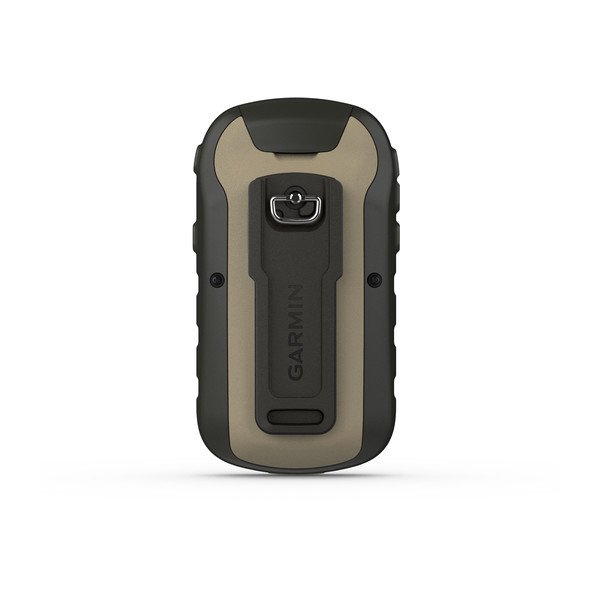
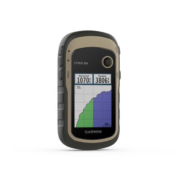
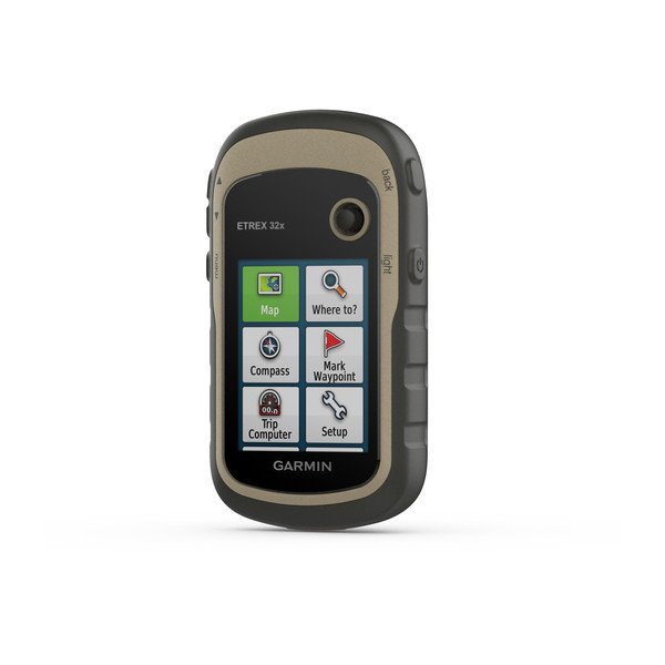
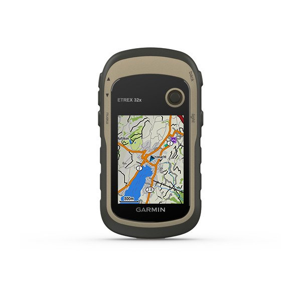
eTrex® 32x
Rugged Handheld GPS with Compass and Barometric Altimeter
- 2.2” sunlight-readable color display with 240 x 320 display pixels for improved readability
- Preloaded with TopoActive maps with routable roads and trails for cycling and hiking
- Support for GPS and GLONASS satellite systems allows for tracking in more challenging environments than GPS alone
- 8 GB of internal memory plus a microSD™ card slot
- eTrex 32x adds a 3-axis compass and barometric altimeter
- Battery life: up to 25 hours in GPS mode with 2 AA batteries
eTrex 22x and eTrex 32x offer the same ease-of-use, durability, and affordability that the eTrex handheld GPS series is known for — along with preloaded TopoActive maps. These devices are perfect for ATVs, bicycles, boats, or hiking.
See the Way:
eTrex 22x and 32x offer enhanced 2.2”, 65K color, sunlight-readable displays. Durable and water-resistant, these handhelds are built to withstand the elements.
Explore the Terrain:
The eTrex 22x and 32x handheld devices come preloaded with road-routable TopoActive maps for outdoor activities that feature streets and trails so you can take the journey off the grid. Now you can know your surroundings — such as waterways, natural features as well as buildings, international boundaries and more. You can also find thousands of points of interest, including shops, restaurants, universities, car parks, and accommodations.
Go Anywhere:
With an array of compatible mounts, eTrex is designed as a handheld — for use on ATVs or bicycles, in boats, or on foot. Use the auto mount capability and City Navigator® NT maps for turn-by-turn driving directions for motorized vehicles, or use the rugged mount for your motorcycle or ATV. Wherever you think you might take eTrex, it has the mapping and mounts to get you there.
Keep Your Fix:
The eTrex series uses both GPS and GLONASS satellite systems so the receiver has the ability to track in more challenging environments than GPS alone. eTrex 32x adds a 3-axis compass and barometric altimeter, making it easy for you to keep your bearings.
Satellite Imagery:
Both devices support BirdsEye Satellite Imagery (subscription required), so you can download and integrate satellite imagery with your maps.
Find Fun:
eTrex 22x and eTrex 32x support paperless geocaching. Upload GPX files straight to your device, and view key information such as location, terrain, and hints from Geocaching.com
General:
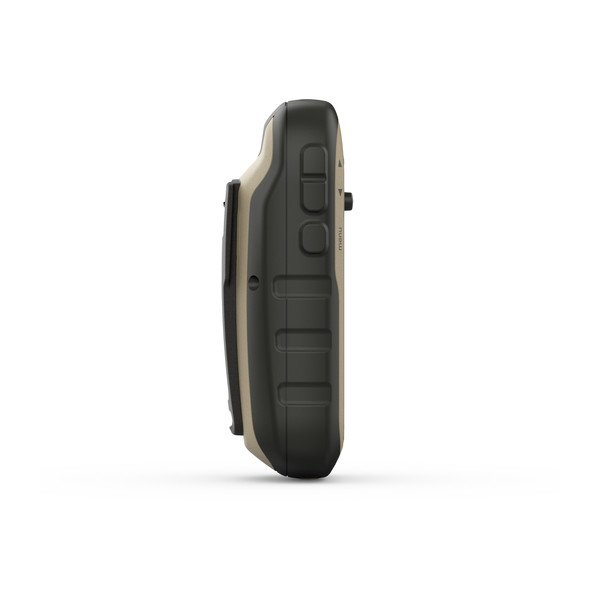
| PHYSICAL DIMENSIONS | 2.1″ x 4.0″ x 1.3″ (5.4 x 10.3 x 3.3 cm) |
|---|---|
| DISPLAY SIZE | 1.4″ x 1.7″ (3.5 x 4.4 cm); 2.2″ diag (5.6 cm) |
| DISPLAY RESOLUTION | 240 x 320 pixels |
| DISPLAY TYPE | 2.2″ transflective, 65K color TFT |
| WEIGHT | 5 oz (141.7 g) with batteries |
| BATTERY TYPE | 2 AA batteries (not included); NiMH or Lithium recommended |
| BATTERY LIFE | 25 hours |
| WATER RATING | IPX7 |
| HIGH-SENSITIVITY RECEIVER | |
| INTERFACE | mini USB |
| MEMORY/HISTORY | 8 GB |
Maps & Memory:
| PRELOADED MAPS | yes (TopoActive; routable) |
|---|---|
| ABILITY TO ADD MAPS | yes |
| BASEMAP | yes |
| AUTOMATIC ROUTING (TURN BY TURN ROUTING ON ROADS) FOR OUTDOOR ACTIVITIES | yes |
| MAP SEGMENTS | 3000 |
| BIRDSEYE | 250 BirdsEye Imagery files |
| INCLUDES DETAILED HYDROGRAPHIC FEATURES (COASTLINES, LAKE/RIVER SHORELINES, WETLANDS AND PERENNIAL AND SEASONAL STREAMS) | yes |
| INCLUDES SEARCHABLE POINTS OF INTERESTS (PARKS, CAMPGROUNDS, SCENIC LOOKOUTS AND PICNIC SITES) | yes |
| DISPLAYS NATIONAL, STATE AND LOCAL PARKS, FORESTS, AND WILDERNESS AREAS | yes |
| EXTERNAL MEMORY STORAGE | yes (32 GB max microSD™ card) |
| WAYPOINTS/FAVORITES/LOCATIONS | 2000 |
| TRACKS | 200 |
| TRACK LOG | 10000 points, 200 saved tracks |
| ROUTES | 200 routes, 250 points per route; 50 points auto-routing |
Sensors:
| GPS | |
|---|---|
| GLONASS | yes |
| BAROMETRIC ALTIMETER | yes |
| COMPASS | Yes (tilt-compensated 3-axis) |
| GPS COMPASS (WHILE MOVING) |
Additional information
| Weight | 0.280 kg |
|---|---|
| Dimensions | 12 × 4 × 3 cm |
| Size | Waist:30"-35", Waist:36"-41", Waist:42"-46" |